9 Best Earthwork Takeoff Software in 2025: Your Easy Guide to Figuring Out Dirt Moving
Are you tired of mistakes when you guess how much dirt there is to move? This guide looks at the best earthwork takeoff software for 2025. We’ll check out tools like InSite Elevation Pro, Carlson Takeoff, and Beam AI.
They help with accurate volume calculations, save you time, and are easy to use. See how construction takeoff software can change your work with earthwork estimation software. It can help you win more jobs and plan better. Let’s find the right earthmoving software for you.
Picture this: you’re on a busy construction site. It’s hot out. You have the project plans spread out on your truck. You’re trying hard to figure out exactly how much dirt you need to move. This is a super crucial first step for any project. But let’s be real: doing these tasks by hand can cause headaches, waste time, and cost a lot of money if you make a mistake. I’ve been looking at software for over five years. I’ve seen how the right tools can make a big, big difference.
That’s where new earthwork takeoff software comes in. It’s not just a simple tool. It’s an enormous help for people who make estimates, contractors, and engineers. It helps anyone get a site ready. This lesson is not just about using a computer instead of a calculator. It’s about using new tech that allows you to be exact, fast, and sure about your earthwork cost estimation and bids.
In this easy-to-read guide, I’ll use what I’ve learned from testing lots of software. I’ll tell you everything you need to know. We’ll start with the basics. We’ll look at the good things about this software. And we’ll point out the essential features. Then, we’ll get to the central part: a good look at the top-rated earthwork takeoff software you can get in 2025.
I’ll share what I think. I’ll show you what makes each tool special. And I’ll help you see which one is best for what you need. It doesn’t matter if you work on small home jobs or big building projects.
When you finish reading this, you’ll know how to pick the best takeoff software for contractors. You’ll also understand how these tools can help you finish on time, save money, and do better than others. Let’s start digging! We’ll find out how the right volume calculation software can make your work much better.
Before we start, let me tell you a little about myself. I’m Ajitkumar Gupta, and I began TrustMySoftware.com. I love looking at new technology. I enjoy finding and testing the latest software and the best free tools. My goal is simple: I want to give you transparent and honest information. I want to help you find software you can trust. I want to help you find tools that fit what you need and help you solve real problems. When I’m not looking at software, I enjoy reading about new things coming in technology. This process allows me to give you helpful advice based on what I’ve seen and learned.
What is Earthwork? Why Being Right Matters So Much
“Earthwork” is a simple idea. It means moving dirt, soil, or rocks from one spot to another. You also shape it to get the land ready for building something. Earthwork can mean:
- Digging (Excavation): Taking out the earth. Consider excavating for a house foundation or a basement.
- Filling: Adding earth to make an area higher or to build up a mound.
- Grading: Shaping the land to make it slope the right way or be level.
- Packing Down (Compaction): Pressing the soil to make it hard and strong for building on.
Earthwork is a big part of almost every building project. New homes, roads, dams, and airports require earthwork. How much earth you move changes many things:
- Project Costs: Paying workers, renting machines, buying fuel, and getting rid of extra dirt all depend on how much earth you move.
- Project Time: Moving the earth takes time. If the estimation is inaccurate, it may result in project delays.
- Using Resources: Knowing how much dirt to move helps you pick the right machines and workers.
- Building Strength: You must grade and pack the land thoroughly. This keeps buildings safe and strong for a long time.
Even a small mistake in estimating earthwork amounts can lead to significant problems. Such mistakes can lead to a project costing significantly more or taking much longer than planned. That’s why getting accurate volume calculations is not just a good idea—it’s super important.
What Exactly is Earthwork Takeoff Software?
Earthwork takeoff software is a special computer tool. Some people call it earthwork estimation software or volume calculation software. It helps you figure out exactly how much earth you need to dig out (cut), move, or add (fill) for a building project. Think of it like a competent helper that understands the land and what needs to change.
Here’s usually how it works:
- Put in Your Info: You start by adding digital plans or site information. This can include items such as PDF plans, CAD (computer-aided design) files (like DWG or DXF), or even information obtained from drones.
- Show the Ground: Then, you show the software what the ground looks like now (original grade). Additionally, you depict the desired final grade based on your plans.
- Figure Out Amounts: The software uses this info to do some smart math. It tells you how much dirt you need to cut from high spots. It also tells you how much dirt you need to fill in low spots. It can tell if you need more dirt or if it will shrink or fluff when moved.
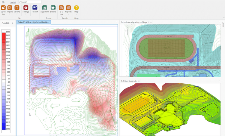
- Get Reports and Pictures: The software gives you detailed reports. These often have 3D pictures, side views (cross-sections), and maps that show where to cut and fill. These reports are helpful for making bids, planning your work, and showing others what needs to be done.
If you make estimates, manage sites, run projects, or are a civil engineer, this software helps with common, challenging problems. Doing these calculations by hand with paper plans, rulers, and calculators takes a very long time. It’s also easy to make mistakes. One wrong number or a misread line on a plan can cost a lot of money.
Earthwork takeoff software does these tricky calculations for you. This makes sure they are very accurate. It also saves you a lot of time so you can do other important things. It doesn’t matter if you’re using site preparation tools for a small yard, making a park, or using earthmoving software for big road projects. This tech is now a key part of modern buildings.
The Big Pluses: Why Use Earthwork Takeoff Software?
You might be thinking, “Is this software worth the money?” Based on all my tests and what people in the business say, the answer is a big YES. The best part is that it solves your most significant issues with manual earthwork estimation.
- Super Accurate Dirt Counts: This is the biggest plus. The software uses exact digital measurements. This feature gets rid of guessing, and mistakes people make when doing it by hand. This means you get very accurate volume calculations for cutting, filling, taking off topsoil, and more. My experience: I’ve seen a 10% to 20% difference (or even more!) between hand takeoffs and software ones. For earthwork, that small percentage means a lot of money.
- Saves a Lot of Time: What used to take days or weeks of tedious math by hand can now often be done in hours. At times, it can be completed in just a few minutes! This time-saving automation speeds up your whole job. You have the opportunity to bid on more projects and respond to clients more promptly.
- Better Project Planning: When you know the exact amounts, you can make much better plans for how long the project will take and how much it will cost. You’ll know what machines you need, for how long, and how to plan your workers’ time. Such information is super crucial for earthwork project planning.
- Improved Cost Estimates: Accurate material and dirt quantities ensure more accurate cost estimates. This protects your profits. It helps you not bid too low (and lose money) or too high (and lose the job). It also means fewer money surprises once you start working. This feature is key for earthwork cost estimation.
- Easier to share Info: Many software choices give you clear 3D pictures, cut/fill maps, and detailed reports. These pictures make it easier to show clients, bosses, and workers what the project is about. This makes sure everyone knows what’s going on.
- Win More Bids: Faster, more accurate bids mean you can compete better. You can give clients professional-looking, detailed plans that make them feel optimistic about hiring you. This aspect is crucial for software used in earthwork bidding.
- Use Your Stuff Wisely: When you know exactly how much dirt to move, you can plan your machines (like bulldozers and trucks) and workers better. This means less waiting around and less wasted money.
- Precise takeoffs based on data can prevent arguments with clients or other workers regarding the amount of dirt moved. A digital record and a straightforward method for performing the math are present.
Numbers from the industry show how helpful these tools are. For example, a 2024 study by Construction Tech Insights said that companies using special takeoff software had 15% fewer mistakes in their estimates. They could also bid on 20% more jobs. When you use this tech, you’re not just buying software. You’re investing in doing things well, being accurate, and making more money on your building projects.
Why Earthwork Software is a Must-Have, Not Just a Nice-to-Have
In today’s construction world, things move fast, and everyone wants the job. Using old ways to figure out something as crucial as earthwork is a considerable risk. Earthwork takeoff software is not just a handy tool anymore. It’s something you need. It directly affects whether your project will work out and whether your company will make money. Here’s why it’s so crucial for you:
- Stops Costly Mistakes: I can tell you that doing math by hand is full of chances for errors. A small math mistake, reading a line wrong on the plans, or missing a part of the site can cost thousands of dollars. You might have to redo work or buy more materials. The software considerably lowers this risk by being very exact.
- Improves Your Bids so You Win More: Your bid is often the first thing a client sees about your work. Reasonable estimates let you give bids that are fair and make you look good. You won’t have to worry about pricing too low and losing money or pricing too high and not getting the job. This is crucial for takeoff software used in civil construction and for all contractors, regardless of their size.
- Utilize Your Machines and Workers Efficiently: Consider the impact of sending too few trucks to a site. This causes delays. Sending too many trucks results in idle machines and fuel waste. When you know exactly how much dirt to move and where it goes, you can use your machines, fuel, and workers in the best way.
- Keeps Projects on Time and Budget: Delays in building cost a lot. Wrong earthwork estimates often make projects late. Planning with software helps you create effective schedules. This makes the project go smoother and enables you to finish on time.
- Helps You Find Better Ways to Build (Value Engineering): Some software lets you quickly try out different plans for grading the land. This enables you to find cheaper ways to do the project. You can then offer these innovative ideas to your clients.
- Better Records and Proof: Digital takeoffs give you a clear record of how you got your numbers. This is useful if someone checks your work for changes or disputes.
Simply put, this software helps you handle the risks of moving the earth. It also enables you to do your job in the best way possible. It doesn’t matter if you’re a small contractor trying to make your business bigger or a large company doing big earthwork projects. These tools give you the facts you need to do an impressive job.
Important Things to Look For: Picking Your Earthwork Software
Not all earthwork takeoff software is the same. To get the best value and find a tool that really helps you, it’s essential to look for things that fit your type of project and how you work. Here’s what I’ve learned you should look for first:
- Easy to Use (User-Friendly Interface – UI):
- Why it’s essential: You and your team shouldn’t need to be computer experts to use the software. A simple, clear screen makes it easier to learn, less frustrating and helps you get work done faster.
- Look for: Easy-to-find buttons, steps that make sense, screens you can change, and help that’s easy to find (like pop-up tips or videos).
- Pro-Tip: Many companies offer free tries. Use them to see how easy the software is. Can you do a simple takeoff in the first hour?
- Can It Read Your Files? (Data Import):
- Why it’s essential: The software needs to work with the kinds of files you get from others.
- Look for: Support for different file types like PDF (clear ones and scanned ones), CAD files (DWG, DGN, DXF), LandXML, and now, info from drones or scanners. Furthermore, check if it works with newer or older versions of these files.
- Is It Accurate? (Calculation Engine):
- Why it’s essential: This is the primary job! The software must employ effective mathematical methods, such as average end area or TIN-to-TIN, to accurately calculate the amounts of dirt.
- Look for: Ways to set the old ground level and the new planned level, handle tricky grading, figure out cut/fill, topsoil removal, and materials under the ground. It should also let you set how much dirt swells or shrinks.
- Can You See It in 3D? (3D Visualization):
- Why it’s essential: Understanding is essential because seeing provides clarity. 3D pictures of the site, where you cut and fill, and the planned grades can help you find problems, explain plans better, and check your work.
- Look for: 3D views you can move around, ways to see side views (cross-sections), and maps with colors to show cut and fill areas.
- What types of reports are available? (Reporting):
- Why it’s essential: You need clear, complete reports for bidding, planning, and keeping records.
- Look for: Report styles you can change, ways to save reports in common types (like Excel or PDF), and lists of amounts (like by area or by depth).
- Does this software integrate well with your other tools? (Integration):
- Why it’s essential: Software that doesn’t connect to other tools makes more work. If it connects with your estimating tools, planning tools, money tools, or GPS machine control, it makes things smoother.
- Look for: Direct connections or easy ways to move info in and out. Drone integration in earthwork software is an enormous help for today’s work.
- Can You Change It to Fit Your Needs? (Customization):
- Why it’s essential: Understanding the importance of customization is crucial because each project has unique requirements. The software should let you change it for what you need and the types of projects you do.
- Look for: Ways to make your lists of materials, change how it does math, and use different ways to measure things.
- Help and Learning (Support and Training):
- Why it’s essential: Understanding the importance of good help is crucial because even the best software can be complex to use without it.
- Look for: Good instruction books, online videos, quick help from customer service (phone, email, chat), and training classes. Check what other users say about how practical the help is.
- In the cloud or on your computer? (Cloud-Based vs. Desktop):
- Why it’s essential: Cloud-based earthwork takeoff lets you use it anywhere and makes it easier to work with your team. Desktop software might improve if you need to work without the internet or have special security needs.
- Look for: Features that fit how your team works and what computers you have. Cloud tools often have monthly fees, while desktop tools might be a one-time cost with yearly fees for updates.
- Extra Fancy Features (Think About These if You Need Them):
- AI-based automation: Tools that can find things on plans by themselves.
- Phasing and sequencing: For planning earthwork in stages.
- Haul analysis: Figuring out the best ways to move dirt around.
- Material tracking: Keeping track of dirt piles and how much material you use.
Note: Don’t be wowed by a long list of features. Focus on the ones that will fix your most significant problems and make your main earthwork takeoff job better. The best software for earthwork estimation for you will be the one that fits into how you already work and gives you excellent results easily.
Common Problems with Doing Earthwork Takeoffs by Hand (And How Software Fixes Them)
Before examining the software, it is crucial to understand the common problems associated with traditional manual methods. As a software detective, I’ve seen these problems cause trouble on many projects:
- Wastes Too Much Time: Measuring by hand from paper plans, doing math, and checking everything takes a very long time.
- Software Fix: Greatly cuts down math time with automation. This lets estimators bid on more jobs.
- People Make Mistakes: It’s easy to read scales wrong, make math errors, miss areas, or misunderstand lines on plans. These mistakes can cost a lot.
- Software Fix: Digital exactness gets rid of most chances for human math errors. This leads to more accurate volume calculations.
- Hard for Tricky Sites: Land that is not flat, has many layers of dirt, or has complex grading plans is extremely difficult to figure out right by hand.
- Software Fix: Easily handles complex shapes and layers of materials using smart math.
- Hard to see clearly: It’s tough to picture where you need to cut and fill or find design problems just from 2D paper plans.
- Software Fix: Gives you 3D models, side views, and cut/fill maps so you can understand better and check for mistakes.
- Changes Are a Pain: It’s tough to really picture where you need to cut and fill, or find design problems, just from 2D paper plans.
- Software Fix: Let you make quick updates. If you change a design, the software quickly redoes the math for the dirt amounts.
- Different Ways of Doing It: Different estimators might use slightly different hand methods. This can lead to different results that don’t match.
- Software Fix: Makes everyone use the same way to do the math. This makes sure results are the same across projects and users.
- Not Enough Detail in Reports: Making complete, professional-looking reports by hand is another job that takes a lot of time.
- The software generates detailed and customizable reports for you. This looks more professional and helps you share info better.
Knowing these problems shows why getting good earthwork takeoff tools is a brilliant idea for any construction business that works with sites.
Top 9 Earthwork Takeoff Software for 2025: A Closer Look
Okay, let’s get to the good stuff. I’ve looked at many choices. I focused on what they can do, what users say, new ideas, and if they are worth the money. Here are nine of the top-rated software options for earthwork takeoffs you should look at in 2025. The “best” one for you depends on your needs, project size, and budget.
Ratings are what people generally think based on user reviews and how well-known the software is. Features and prices can change, so always check with the company that sells the software.
1. InSite Elevation Pro
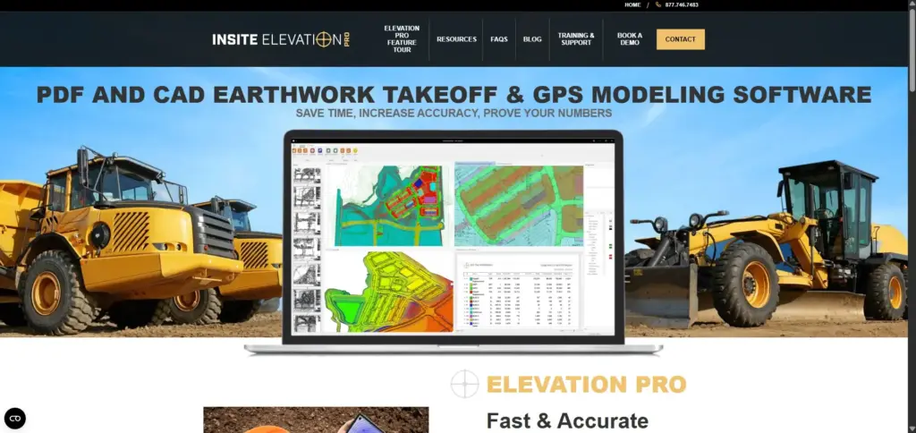
- Overview: InSite Elevation Pro is a popular, special earthwork takeoff software. It’s ideal for contractors who need it to work closely with their fieldwork, especially with GPS on machines. People who move a lot of dirt find it perfect.
- Key Features:
- Works with GPS on Machines: Easily make models for machines guided by GPS. This makes sure the design is followed correctly in the field.
- Uses Drone Info (Photos & LiDAR): Can easily use and work with info from drone surveys. This helps create a picture of the existing ground and check grades. This capability is crucial for modern site work.
- Handles Many File Types: Works with PDFs, CAD files (DWG, DXF, DGN), LandXML, and more. This gives you choices for where your info comes from.
- Figures Out All Materials: Calculates cut/fill, dirt to remove, paving components (like asphalt and concrete), stone, and amounts for trenches.
- Pros:
- Easy to Use for Earthwork: Even though it’s powerful, users often say it’s pretty simple to use for its main jobs. This feature allows individuals familiar with earthwork to learn it more quickly.
- Great Pictures: It features robust 3D visualization tools that assist users in viewing cut/fill areas, layers of soil, and the entire site. This helps find mistakes and share info.
- Works Fast: Users say it does calculations quickly, even for big or tricky projects.
- Good Reports for Bids: Makes clear, detailed reports that are useful for sending bids and for your team to look at.
- Cons:
- Just for Earthwork: It’s excellent for earthwork and getting sites ready, but it might not do as much as some general construction estimating tools.
- Printing (In the Past): Some users in the past said it was difficult to print all the takeoff details directly. New versions may address this issue. Always check what it can do now.
- Cost: It can cost a good bit of money, especially for smaller contractors. But its special features often make it worth it.
- Who is it Really For? Earthwork contractors, digging companies, and civil contractors who use GPS on machines and drone information a lot. Suitable for those who need very exact takeoffs that can be used directly for field models.
- Notes: “When I tried it, sending info right to machine control was a big plus. Being able to quickly check grades with drone info saves a lot of time and lowers risk. A good choice for serious dirt movers.”
- Ratings (What People Think): 4.5 out of 5
2. Carlson Takeoff
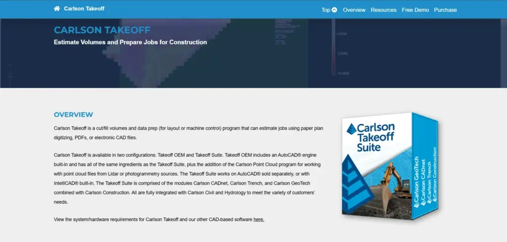
- Overview: Carlson is a well-known name for civil engineering and survey software. Their Takeoff tool shows this strong background. It’s known for being exact and having many tools that do more than figure out dirt amounts.
- Key Features:
- Exact Earthwork Math: Uses different ways to do math (TIN to TIN, grid, section) for very accurate results, which meets engineering standards.
- Easy 3D Models & Pictures: It offers powerful 3D viewing features, such as drive-through views and shading. This helps you understand tricky sites.
- Works Well with Other Data: Connects smoothly with Carlson’s other survey and civil design tools. It also supports many common file types.
- Advanced Site Features: Has tools for looking at layers of dirt from boreholes, digging trenches, figuring out road designs, and balancing materials.
- Pros:
- Engineering-Level Accuracy: Engineers trust it because its math is good and it follows civil engineering rules.
- Many Features: Offers many tools that are good for different kinds of civil projects, not just basic earthwork.
- Strong CAD Power: Built on a robust CAD system, it provides powerful drawing and editing tools.
- Good Help and Learning Stuff: Carlson is known for excellent customer help and lots of learning materials.
- Cons:
- Takes Time to Learn: Because it does so much and has so many features, it can take longer to learn than simpler, more focused tools. Special training often helps.
- Cost: It’s a professional tool, so its price shows what it can do. It might cost more than some basic options.
- Screen Can Look Old (to some): Even though it’s powerful, some users might think its screen looks less new than newer web-based apps. This is just what some people think.
- Who is it Really For? Civil engineers, surveyors, bigger construction companies, and contractors who need very detailed, engineering-level takeoffs. It’s also suitable for those who use other civil design tools. It excels in intricate road and building projects.
- Notes: “Carlson Takeoff is strong because it’s exact and has a lot of depth. If your projects need serious engineering accuracy and you do many different civil jobs, this is a top choice. Being able to model what’s under the ground is a big plus.”
- Ratings (What People Think): 4.6 out of 5
3. AGTEK Gradework 4D (used to be just AGTEK)
- Overview: AGTEK has been a top name for a long time in earthwork and heavy civil construction takeoffs. Their Gradework 4D tool is powerful. It’s made for moving a lot of dirt and modeling big sites.
- Key Features:
- Made for Big Civil Jobs: It was designed from the start for large earthwork, highway, and site-building projects.
- Advanced 3D Site Models: Creates detailed 3D models so you can see, study, and control machines.
- Material and Hauling Study: Has innovative tools for figuring out amounts of different materials, finding the best ways to haul dirt, and managing how dirt is moved around.
- Works with Drones and GPS: Very proficient at using drone info and sending models to GPS machine controls and site systems.
- Pros:
- Common Choice for Big Civil Contractors: Because it’s been around a long time and focuses on this work, many big earthmoving companies use it.
- Very Accurate and Detailed: Known for being very exact when figuring out complex earthwork amounts and handling lots of data.
- Powerful Tools to Save Money: Features like haul study can make a big difference in how quickly projects go and how much they cost on big sites.
- Strong Reports: Makes complete reports that are just right for big civil projects.
- Cons:
- Very Hard to Learn: AGTEK is a significant and robust system. It takes a lot of time and training to learn it well.
- Costs a Lot: It’s one of the most expensive tools you can buy. This is because it’s so special and consequential. It’s usually for bigger companies.
- Too Much for Small Jobs: All its features might be too much and too complicated for smaller contractors or simpler earthwork jobs.
- Who is it Really For? Large, heavy civil contractors, highway builders, and companies involved in extensive excavation and complex site construction are its target audience. Businesses requiring sophisticated models, comprehensive haul studies, and robust GPS connectivity are the target audience.
- Notes: “AGTEK is like the champion for huge earthmoving jobs. If you’re moving millions of cubic yards of dirt, its smart tools can save you a lot of money. But it’s not for beginners or small budgets.”
- Ratings (What People Think): 4.7 out of 5 (for the companies it’s made for)
4. MudShark (by BrightBox Software)
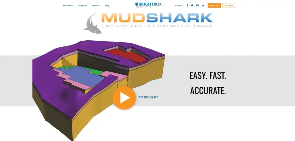
- Overview: MudShark tries to make earthwork estimating easier with some new ideas. Its one-click contour capture and excellent drone data use are special. It’s made for builders, estimators, and engineers who want to work fast.
- Key Features:
- One-Click Contour Lines: A cool feature that lets users quickly trace contour lines from PDF or image files. This makes putting in the first info much faster.
- Excellent Drone Data Use: Has strong tools for using point clouds and surfaces captured by drones.
- Clear 3D Pictures: Gives easy-to-understand 3D models that help users see cut/fill, depths, and site features well.
- Many Takeoff Tools: Handles different earthwork math, like topsoil removal, mounds, trenches, and material amounts.
- Pros:
- Easy-to-Use Screen: People usually say it’s easier to learn and use than some of the older, more complex systems.
- Fast Takeoff Work: The contour capture and smooth workflow can make takeoffs much quicker, especially from PDF plans.
- Good Value: Often seen as having a good mix of features and ease of use for a fair price.
- Helpful Support: Users often say good things about the customer help from BrightBox Software.
- Cons:
- Advanced Features Might Take Time: While the basics are easy, learning all its advanced options and how to change settings may take some time.
- Primarily for Earthwork: Like some other special tools, it might not have all the features for different types of construction estimating besides site work.
- Who is it Really For? Small to medium-sized builders, digging contractors, landscapers, and civil estimators. This tool is ideal for individuals seeking a quick and user-friendly solution for earthwork takeoffs, particularly those who frequently utilize PDF plans or drone data.
- Notes: “MudShark’s ‘one-click’ contour tracing is really neat and saves a lot of time on PDF plans. It also handles drone data very well. A great choice for people who want power but not something too hard to use.”
- Ratings (What People Think): 4.4 out of 5
5. Beam AI

- Overview: Beam AI is very new and uses artificial intelligence (AI) to do earthwork takeoffs automatically. It tries to lessen significantly how much you have to do by hand by “reading” plans and reports. This is a newer company making a big splash.
- Key Features:
- AI Does the Work: It says it can read grading plans, reports about soil, and spec papers to get info and figure out amounts automatically.
- Big Time Saver: Their ads say it can save up to 90% of takeoff time by doing the most complex parts of the job for you.
- Looks at Everything: Made to find not just the clear earthwork but also details like how deep pipes are from utility plans.
- Helps You Plan Better: By doing the takeoff for you, it gives estimators more time to check estimates, look for better ways to do things, and add more value.
- Pros:
- Could Save Tons of Time: If the AI works, the time saved could be excellent for busy estimating teams.
- Less Boring Handwork: Does the often tedious job of tracing lines and putting in info from plans for you.
- New Idea: This is how future earthwork estimation technology might look. It will get even better as AI gets smarter.
- Use It Anywhere (Cloud-Based): Usually offered as a cloud service so that you can use it from anywhere.
- Cons:
- Depends on AI Being Right: How accurate the takeoff is depends a lot on whether the AI can correctly understand different kinds of plans and how good they are. A person still needs to check the work.
- “Black Box” Feel: Users might not have as much direct control or understanding of how the math is done compared to older software.
- Newer Tech: Because it’s newer, not as many people might have used it for a long time compared to older, well-known software.
- Data Safety: For AI to work, plans are sent to the cloud. So, how safe your data is is an important thing to think about.
- Who is it Really For? Construction companies, particularly those engaged in frequent bidding, are open to exploring innovative approaches. Businesses aim to utilize innovative AI technology to surpass their competitors. Estimators aspire to reduce their manual data entry time significantly.
- Notes suggest that Beam AI is a promising technology. The idea of AI-based earthwork takeoff is exciting. A person still needs to check things, but if they can do the first significant part of the work, that’s a game-changer. It’s worth trying on a small project.”
- Ratings (What People Think): 4.3 out of 5 (with a lot of promise)
6. HCSS HeavyBid
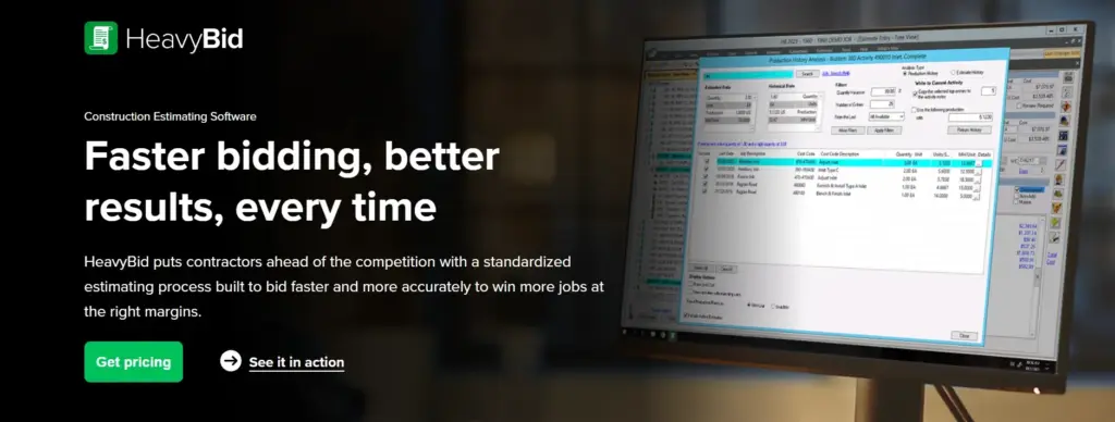
- Overview: HCSS HeavyBid is more than just a takeoff tool. It’s a full estimating and bidding system used a lot in heavy civil construction. Its earthwork tools are part of this bigger, more powerful system.
- Key Features:
- Strong Estimating Power: Handles complex bids with thousands of items, tricky crew and machine setups, and managing other companies you hire.
- Advanced Math: While not just an earthwork tool, it puts earthwork amounts into a complete bid package with smart cost math.
- Learns from Old Jobs: Let you use info from past projects to make future bids more accurate.
- Manages Quotes and Compares Bids: Makes it easier to get and compare prices from suppliers and other companies.
- Pros:
- Top Choice for Heavy Civil Bidding: Many big construction firms use it because it’s powerful and does a lot.
- Handles Complex Jobs Well: Great at managing big projects with many bid items and complex costs.
- Great Customer Help: HCSS is known for its excellent customer help and community of users.
- Grows with You: This is good for companies that are getting bigger and need a system to handle more complex bidding.
- Cons:
- Very Hard to Learn: HeavyBid is a significant and complex system. It takes a lot of training and time to learn it all.
- Costs a Lot to Own: It’s a top-level tool and costs a lot, including setup and training.
- Earthwork is Just One Part: If you only need earthwork takeoff, HeavyBid might be too much. Its strength is in preparing the whole bid.
- Who is it Really For? Medium to large, heavy civil construction companies that need a robust system for estimating, bidding, and managing complex projects. Companies where earthwork is a big part, but not the only part, of their bids.
- Notes: “HeavyBid is a big name in heavy civil estimating. Its earthwork math is good, but its real power is in building the whole bid. If you need to manage bids for big projects, it’s a top choice.”
- Ratings (What People Think): 4.8 out of 5 (as a complete bidding system)
7. Autodesk Civil 3D
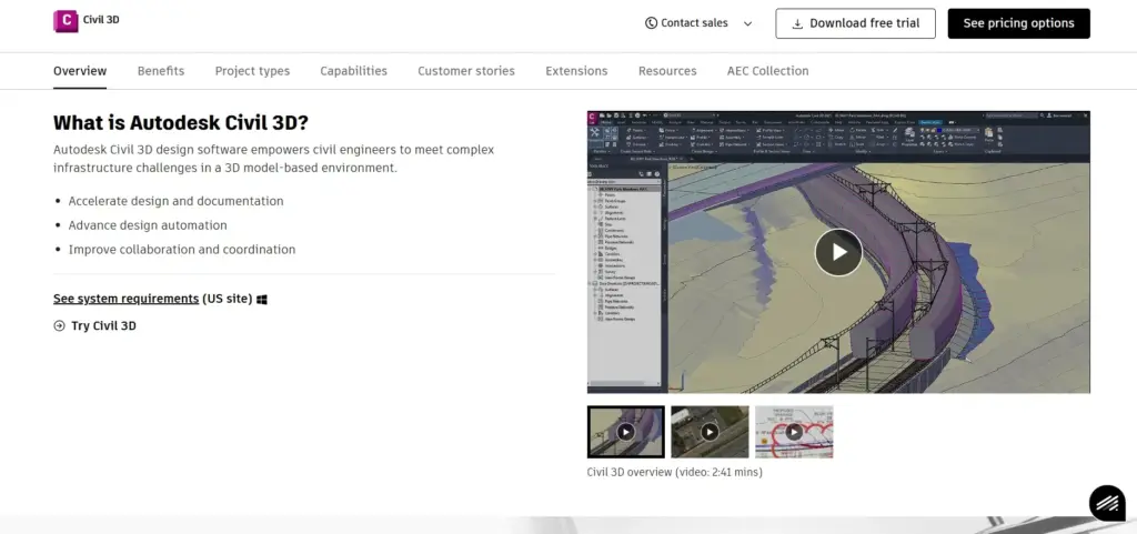
- Overview: Autodesk Civil 3D is a top design and planning tool for civil engineering. Its main job is design, but it has strong tools for making surfaces and figuring out earthwork amounts right from the design model.
- Key Features:
- Design and Figuring Together: Earthwork amounts come right from the civil design model. This makes sure the design and the quantity takeoff match.
- Powerful Surface Models: Has advanced tools for making, changing, and looking at ground surfaces (TINs), contour lines, and paths.
- Dirt Volume Reports: Makes detailed reports about dirt amounts (like cut/fill or how far dirt is moved) by comparing surfaces.
- BIM for Big Projects: Supports Building Information Modeling (BIM) for big building projects. This helps with teamwork and managing info.
- Pros:
- Main Design Tool: It’s the standard tool for civil design. This means many projects start or finish in Civil 3D.
- Updates Automatically: Changes to the design model can automatically update dirt calculations. This saves a lot of rework.
- Complete Set of Civil Engineering Tools: Offers many tools for road design, pipe systems, grading, and more. It’s a one-stop shop for many civil engineers.
- Works with Other Autodesk Tools: Connects smoothly with tools like Revit, Navisworks, and InfraWorks.
- Cons:
- Extremely Hard to Learn: Civil 3D is a very complex software with lots of features. It’s mostly for engineers and designers, not estimators who don’t have an engineering background.
- Cost: It’s a professional Autodesk product, so it costs a good bit for a subscription.
- Too Much for Just Takeoff: If your only job is earthwork takeoff from plans someone else made (not design), Civil 3D is probably too powerful and complex.
- Not Mainly an Estimating Tool: It doesn’t have the bidding and cost estimating features that special estimating software has.
- Who is it Really For? Civil engineers, designers, and engineering companies that design big building projects need to figure out earthwork amounts as part of that design work. It’s not as good for contractors who need to do takeoffs from others’ plans.
- Notes: “For designers, Civil 3D is the best. Being able to put earthwork amounts right into the design work is a huge plus. But for a contractor who just needs to do takeoffs from PDFs, the application is like using a giant hammer for a small nail.”
- Ratings (What People Think): 4.7 out of 5 (as a civil design tool that can also do takeoffs)
8. PlanSwift with Earthwork Pro (Plugin)
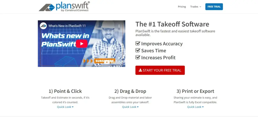
- Overview: PlanSwift is a very popular general takeoff and estimating software known for being easy to use. The “Earthwork Pro” add-on (plugin) by Tradesman Software gives it special tools for earthwork math, making it a flexible choice.
- Key Features:
- Easy Main Program (PlanSwift): PlanSwift itself is known for its simple point-and-click way to measure areas, lengths, and counts from digital plans.
- Earthwork Pro Plugin: Adds special tools for earthwork. These include setting existing and planned ground levels, figuring out cut/fill, topsoil removal, and making 3D views.
- Drag-and-Drop Parts: PlanSwift lets you make groups of materials and labor. These can be used with Earthwork Pro amounts for cost estimates.
- Works with Excel: It is easy to connect with Excel for sending out data and doing more study or reporting.
- Pros:
- Easy to Learn (PlanSwift Basics): Many estimators find PlanSwift easy to learn for general takeoff jobs.
- Suitable for Many Trades: PlanSwift can be used for many types of construction takeoffs, not just earthwork. This makes it a good all-around tool if you need that.
- Can Be Cheaper: PlanSwift itself has a fair price. The plugin costs extra, but together, they can still be a good deal.
- Suitable for PDF Takeoffs: Works very well for getting info from PDF plans.
- Cons:
- Needs the Plugin: The main earthwork tools depend on the Earthwork Pro plugin. This is an extra thing to buy and manage.
- Not as Special as Dedicated Tools: It can do the job, but the earthwork features might not be as deep or advanced as software made only for earthworks, like AGTEK or InSite.
- May Slow Down on Very Big/Tricky Sites: It might not work well for extremely large or complex earthwork projects compared to high-end special tools.
- Who is it Really For? General contractors, builders, and earthwork takeoff for small contractors who need a flexible takeoff tool that can also handle earthwork pretty well. Suitable for those already using PlanSwift or looking for an easy-to-learn tool that covers many trades.
- Notes: “PlanSwift is great for general takeoffs. The Earthwork Pro plugin makes it useful for site work too. If you need one tool for different takeoffs and your earthwork needs are not too complex, the software is a good, easy-to-use choice.”
- Ratings (What People Think): 4.2 out of 5 (as a combined tool)
9. WinEx Master (by Trakware)
- Overview: WinEx Master is part of Trakware’s group of construction software. It focuses on giving complete and accurate cut-and-fill calculations with strong reports and pictures.
- Key Features:
- Complete Cut/Fill Study: Detailed math for different earthwork situations, including layers of dirt, ground under roads, and balancing the site.
- Great Reports and Pictures: Offers strong reporting choices and clear 3D pictures to help understand and show takeoff data.
- Easy-to-Use Screen (Their Goal): Tries to have an easy screen to make complex math simple to do.
- Gets Updates Often: The software is always being worked on with new features and fixes based on what users say.
- Pros:
- Accurate and Detailed: Known for giving exact and complete earthwork quantity reports.
- Good Picture Tools: Helps users see site conditions and planned changes well in 3D.
- Focuses on Earthwork Details: It has special features for earthmoving contractors like site balancing and figuring out dirt pile amounts.
- Cons:
- May Cost More: Often sold as a top special tool, which can mean it costs more than some general takeoff software or simpler earthwork tools.
- Fewer Users (Compared to Big Names): Might have a smaller group of users compared to some extensive, well-known software. This can affect how easy it is to find outside help or talk to other users.
- Learning Curve for Advanced Parts: While it tries to be easy, learning all its advanced reporting and study tools might still take some work.
- Who is it Really For? Earthwork contractors and estimators who need very detailed and accurate cut/fill math with advanced reporting. Those who care most about exactness and complete data for their earthmoving projects.
- Notes: “WinEx Master is known for detailed earthwork study. Its reporting tools are a strong point, letting you share complex info clearly. A favorable choice for contractors who need that extra detail in their takeoffs.”
- Ratings (What People Think): 4.3 out of 5
How to Pick the Best Earthwork Takeoff Software for Your Business
Choosing the right earthwork takeoff software can feel like trying to find your way in a maze, but it doesn’t have to be. As your software detective, take it step by step to find the perfect match. Here’s an easy guide:
Step 1: Think About What You Need & Your Problems
Before you even look at software names, understand what you need:
- Project Size & How Hard They Are: Are you doing small home lots, big shopping centers, or massive highway projects? How complex your usual jobs are will decide how fancy the software needs to be.
- Types of Info You Use: Do you mostly work with PDFs and CAD files, or are you using drone info? Make sure the software can handle them.
- How You Work Now & Where You Get Stuck: Where do you lose the most time or make the most mistakes in how you do things now? Please consider software that addresses these specific issues.
- Team Size & Computer Skills: How many people will use the software? How good are they with computers now? An easy-to-use interface is essential so everyone can use it.
- Do You Need It to Connect to Other Tools? Does it need to link with your money software, project planning software, or GPS machine control systems?
- Budget: How much can your company spend? Think about the first cost and any monthly or yearly fees.
Step 2: Look Around and Make a Short List
Use this guide and other good places (like online forums for your industry, what friends in the business say, software review sites) to make a short list of 3-5 software options that fit what you need.
Step 3: Look Closely at Features and Compare
For the software on your shortlist:
- Go to their websites.
- Watch demo videos.
- Ask for lists of all their features.
- Pay close attention to how each software does the key things we talked about earlier (how easy it is to use, what files it can open, if it’s accurate, 3D pictures, reports, connections, help).
- Don’t just see if a feature is there, but how well it works.
Step 4: Make Free Trials and Live Demos a Top Priority
This is VERY IMPORTANT.
- Free Trials: Most sellers offer them. Use a real project (or one you did before) to test the software. Can you do a basic takeoff? Is it easy to understand? How long does it take?
- Live Demos: Set up personal demos with salespeople. Get your specific questions ready based on what you need. Ask them to show you how the software handles a job that’s like what your business does.
Step 5: Check User Reviews and Ask People You Know
- Look for honest reviews on sites like Capterra, G2, or Software Advice. Pay attention to what people say about how easy it is to use, how good the customer’s help is, and if it works well.
- Talk to other contractors or estimators you know who use the software you’re thinking about. Hearing from people who use it every day is beneficial.
Step 6: Think About the Total Cost to Own It (TCO)
Don’t just look at the first price. Think about:
- The first cost to buy it or the monthly fee.
- Consider the expenses associated with training.
- Yearly fees for updates or help.
- Cost of any new computer parts you might need.
- How much money you might save because it works better and is more accurate (Return on Investment – ROI).
Step 7: Check How Good the Seller Is and Their Support
- How long has the seller been in business?
- What do people say about their customer service and tech help? Fast, smart help can be a real lifesaver.
- Are they always making the software better and updating it?
Common Mistakes to Stay Away From When Choosing:
- Not Trying Free Trials or Demos: Never buy software without trying it. Testing it is the only way to know if it’s right for you.
- Forgetting About Learning Time: A powerful tool is no good if no one can figure out how to use it. Think about time and money for training.
- Only Looking at Price: The cheapest choice isn’t always the best deal. Consider the potential long-term savings that can be achieved through accuracy and efficiency.
- Not Checking Connections: If the software doesn’t work with your other essential tools, you’ll have separate piles of info and extra hand work.
- Not Asking the People Who Will Use It: The people who will use the software every day (your estimators) should help pick it. They must like it.
Choosing the right software is about finding that perfect balance: a tool strong enough for your tech needs but easy enough for your team to use well, and all for a price that works for your business. Take your time, conduct thorough research, and rely on your instinct!
What’s Next: Cool New Things in Earthwork Takeoff Tech
The world of earthwork takeoff software is constantly changing. As a software detective who is always looking at what’s new, I see some incredible things happening that will shape the future of earthwork estimation technology. Knowing about these can help you pick software that will not only work for you today but also grow with you.
- More innovative Software with AI (Artificial Intelligence) and Machine Learning (ML):
- What it means: Software is getting smarter. Tools like Beam AI are just the start. We’ll see more AI features that can automatically find things on plans (like contour lines, high spots, and buildings), suggest the best ways to grade, and even guess potential problems based on old info.
- What it does for you: Much less hand data entry, faster first takeoffs, and more innovative ways to look at things. AI-based earthwork takeoff will become more common.
- Better Drone Use and Seeing the Real Site:
- What it means: Drones are already essential for site surveys. The software will connect even better with them. This will allow for quick updates on how the site looks now, checking progress against design plans, and automatic checks of how the work was built. LiDAR and other ways to capture what the site really looks like will be easier to get.
- What it does for you: More accurate starting info, faster ways to track progress, and fewer differences between the design and the real site. Think of drone integration in earthwork software, but it’s even better.
- Working Together on the Cloud and Using Mobile Devices:
- What it means: Cloud-based earthwork takeoff tools will keep being popular. They offer more freedom, make it easier for teams to work together (even if they are in different places), and let you see info from phones or tablets in the field.
- What it does for you: Better talking between the office and the field, sharing info in real-time, and not needing to be at a specific office computer.
- More Focus on Being Green and Helping the Environment:
- What it means: Future software might have more tools for planning earthmoving in ways that are good for the earth. This could mean finding the best haul routes to use less fuel, disturbing the site less, or figuring out the carbon footprint of earthwork jobs.
- What it does for you: Helping contractors follow environmental rules and meet client requests for greener buildings.
- Working Together Better (Interoperability) and Open File Types (like IFC):
- What it means: A bigger push for software to “talk” to each other easily using open file types like IFC (Industry Foundation Classes) for BIM. This means less lost info and less rework when moving info between different programs.
- What it does for you: Smoother work through the whole project, from design to building to running it.
- Guessing Risks to Avoid Problems (Predictive Analytics):
- By looking at info from old projects, the software might help find possible risks in new projects (like areas that might cost too much or delays that might happen because of soil types or weather).
- What it does for you: Better ways to manage risks before they happen and more intelligent choices when bidding and planning.
My advice is to look for sellers who are not just keeping their current tools working but are also putting money into these new technologies. Using new, innovative tools can give you a big step up on others and make your company look like a leader in the construction business.
Conclusion
Choosing the best earthwork takeoff software is a crucial decision for any builder or contractor who works on-site development. It’s about much more than just stopping a hand process. It’s about investing in being accurate, fast, and making more money on your projects. With the right construction takeoff software, you can stop worrying about guesswork. You can significantly lower the risk of costly mistakes. And you can get back many hours of your valuable time. This lets you focus on what you do best: building.
It doesn’t matter if you’re a single earthwork contractor for small projects looking for something cheap and with a user-friendly interface. Or if you’re a big civil construction company needing advanced earthmoving software with features like drone integration and AI-based earthwork takeoff. There’s a choice on our list that’s right for you. From the strong GPS connection of InSite Elevation Pro to the AI speed of Beam AI or the full bidding power of HCSS HeavyBid, the tools we’ve looked at offer many different things.
My work has shown me that the most important thing is to think about what your projects need. Carefully compare the features that matter most to you. And always, always try out free trials or demos. Test the software where you work with your usual projects. The future of earthwork estimation technology is more digital, automatic, and uses more data. Making a wise software choice today will not only make your work smoother now but will also keep you ready for tomorrow’s challenges.
The power to make your earthwork estimating better is right here. Don’t let old ways slow you down.
What to Do Next & Share Your Thoughts!
Ready to make your earthwork project planning and cost estimation better?
- Look again at the top-rated software options for earthwork takeoffs we talked about.
- Sign up for a free trial of your top 2-3 choices.
If you use these tips, you’ll find software you can trust.
What have you seen with earthwork takeoff software? Do you have a favorite tool or a question I didn’t answer? Please leave a comment below – I’d love to hear from you and help everyone learn! Share this guide with others if it helps you. Your next project’s success could be just a click away.
Frequently Asked Questions (FAQ) about Earthwork Takeoff Software
Q1: What is earthwork takeoff software, in simple words?
A: Earthwork takeoff software is a computer tool that helps you correctly figure out how much dirt or other stuff needs to be moved (dug out or filled in) for a building project. It uses digital plans (like PDFs or CAD files) or drone info to do this. It takes the place of measuring by hand, saves a lot of time, and stops mistakes. It helps make sure your earthwork cost estimation is proper.
Q2: How does this software help my building projects?
A: The main good things are accurate volume calculations (less guessing!), time-saving automation (you save hours of hand work), better project planning (reasonable budgets and schedules), and bids that can win more jobs. It helps cut down on costly mistakes and makes sure you use your machines and workers well. This makes it one of the key site preparation tools.
Q3: What are the most important features I should look for?
A: Look for an easy-to-use interface (easy to learn and use). Make sure it works with your file types (PDF, CAD, drone data). It needs to do math accurately. Good 3D pictures, clear reports, and good customer help are also important. If it connects with other software you use, that’s a big plus.
Q4: How does earthwork takeoff software work with other tools like CAD or drone info?
A: Most new earthwork takeoff software can open CAD files (like DWG or DXF) directly to use design info. Many can also use information from drone surveys (like point clouds) to make models of the site as it is now. This drone integration in earthwork software lets you compare “as-built” (what’s really there) vs. “design” (what’s planned) very accurately. Some can also send info to project planning tools or GPS machine controls.
Q5: Is earthwork takeoff software suitable for small contractors or just big companies?
A: Yes, it is! There are many choices good for earthwork takeoff for small contractors. Look for software with prices that fit (like monthly fees), that are easy to learn, and have features for smaller projects. Tools like PlanSwift with Earthwork Pro or MudShark can be good places to start. Doing things faster and better helps businesses of all sizes.
Q6: How accurate is this software? Can I trust it?
A: If you use it right with good quality info, earthwork takeoff software is much more accurate than doing it by hand. It uses exact digital measurements and the same math rules every time. How good your original plans or survey info is makes a difference. Most good software gives results you can trust for bidding and planning. It dramatically cuts down on human mistakes.
Q7: What’s the main difference between special earthwork software and general construction takeoff software?
A: Special earthwork software (like InSite Elevation Pro or AGTEK) has significantly advanced tools just for complex earthmoving math. This includes detailed cut/fill figuring, modeling layers of dirt, planning haul routes, and sending info right to GPS machine controls. General construction takeoff software (like PlanSwift) might cover earthwork as one of many jobs. It often has less detail for earthmoving unless you add a plugin. Choose based on how crucial detailed earthwork figuring is for your business.
Q8: There are so many choices. What’s the best earthwork takeoff software out there?
A: ” I can tell you the “best” depends entirely on your exact needs. For a small contractor who wants something simple for PDF takeoffs, PlanSwift with Earthwork Pro might be best. For a big company doing complex highway jobs with GPS machine control, AGTEK or Carlson Takeoff might be the answer. For super new automation, Beam AI is a top pick. Look at the “Best For” parts in this guide and try a few.
Q9: How much should I think earthwork takeoff software will cost?
A: Prices are very different. Simpler tools or those that charge per project might start at a few hundred dollars a year or a small monthly fee. Bigger, more special systems (like AGTEK or HCSS HeavyBid) can cost thousands or even tens of thousands of dollars a year. This is especially true if many people use it and you need training. Always get exact prices and ask if it’s a one-time cost or a yearly/monthly fee. Many offer different price levels.
Q10: What is “cut and fill” in earthwork, and how does software help with it?
A: “Cut” means digging out or removing earth from spots that are too high based on the project design. “Fill” means adding earth to places that are too low. Earthwork takeoff software figures out these cut-and-fill amounts very exactly. It does this by comparing the ground surface now with the planned design surface. This helps make sure the site is balanced or tells you if you need to bring in or take away dirt.
Q11: Can I use earthwork takeoff software for digging trenches and putting in pipes?
A: Yes, many advanced earthwork takeoff tools have parts or special functions for figuring out trench digging amounts, how much dirt to put back, and even pipe lengths for utilities. Software like Carlson Takeoff or Civil 3D are perfect for this.
Q12: What do “swell and shrinkage” mean, and does the software handle them?
A: When you dig the soil out (cut), it usually gets looser and takes up more space (this is swell). When you pack soil down (in a fill), it takes up less space (this is shrinkage). These things are crucial for guessing amounts right. Most professional earthwork estimation software lets you put in swell and shrinkage numbers for different kinds of soil. This helps adjust the figured amounts correctly.